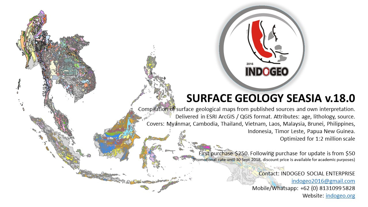
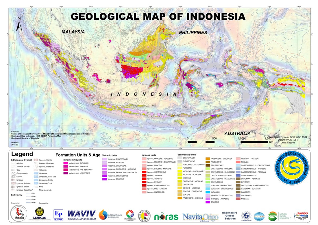
Geologic map of Indonesia and Southeast Asia are available in GIS format, optimized to 1:2,000,000 scale. Countries included in this projects are: Indonesia, Malaysia, Vietnam, Laos, Cambodia, Myanmar, Papua New Guinea, Philippines, Brunei Darussalam and Timor Leste. Shape and layer files are available in WGS-84 system. Compatible for ESRI Arcgis and QGIS. These maps are prepared to provide regional geological understanding to support the industry (e.g. petroleum exploration) or simply for teaching geoscience in classes.
Formation attributes
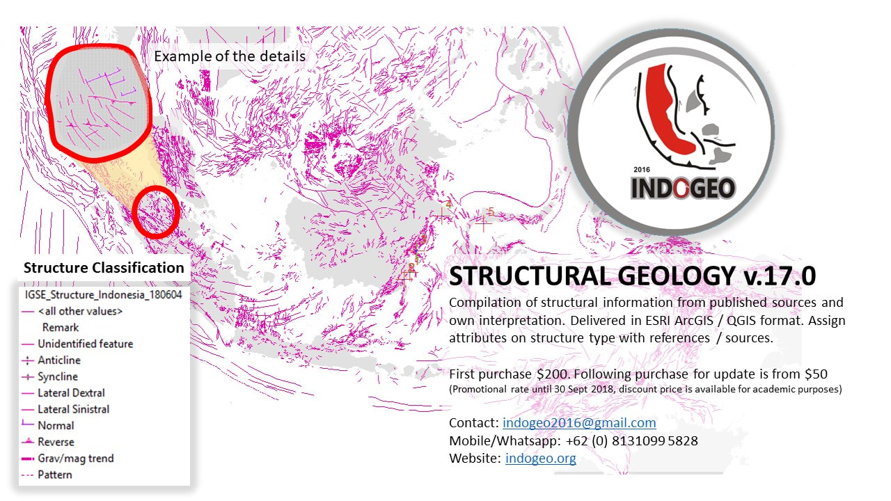
Structure attributes
The team would like to express their gratitude to the sponsors:
1. Lemigas
2. Eksindo Pratama
3. Waviv - Seismic Enhancement
4. Internationa Primacoal
5. PT. AKA Geosains
6. PT. Ceria Nugraha Indonesia
7, Noras
8. Navita Origo Solution
9. Imbondeiro Global Solution
10. PT. Geoservices
11. PT. Geotama
12. Natural Energy Resources
13. PT. Jakindo
To purchase the GIS map:
- Dominant lythology
- Age
- Formation name
- Reference
Structure attributes
- Type of structure (e.g. anticline, sinistral, thrust fault, etc.)
- Deep structure (basement) or shallower structure
- Magnitute classified into 3 level (regional, semi regional, local)
- Remarks
- Reference
The team would like to express their gratitude to the sponsors:
1. Lemigas
2. Eksindo Pratama
3. Waviv - Seismic Enhancement
4. Internationa Primacoal
5. PT. AKA Geosains
6. PT. Ceria Nugraha Indonesia
7, Noras
8. Navita Origo Solution
9. Imbondeiro Global Solution
10. PT. Geoservices
11. PT. Geotama
12. Natural Energy Resources
13. PT. Jakindo
To purchase the GIS map:
- Send a request to [email protected]
- buy online in Tokopedia